See all results
Your
favorites
édition
Become a V.I.P
Log in
Weather
United States
Radar
Mountain
World
Weather
Austria
Prealps
Sonnberglifte Wald am Schoberpass (ski resort)
WEATHER SKI RESORT SONNBERGLIFTE WALD AM SCHOBERPASS
Wald am Schoberpaß - Austria
Sat
15
-
-
Sun
16
-
-
Mon
17
-
-
Tue
18
-
-
Wed
19
-
-
Thu
20
-
-
Fri
21
-
-
Sat
22
-
-
Sun
23
-
-
Mon
24
-
-
Tue
25
-
-
Wed
26
-
-
Thu
27
-
-
Fri
28
-
-
Sat
29
-
-
+
Day
Time / Hour
Compare
Today's Forecast
Forecast produced by
Cyril BONNEFOY
Updated at
22h15
- Next update at
04h30
(local time)
In Short
N.C.
Ski resort info
Follow the weather
live
Hour by hour
Weather comparator
Expert’s summary
Today in Sonnberglifte Wald am Schoberpass, rain and snow perturbation: It will only affect the region in the first half of the day.
Temperatures will vary between -1 and 4°C.
The reliability of the situation is good.
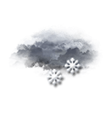
3:00 to 6:00
-1°
Feels Like -1°
Gusts
10 km/h
Calm
Overcast and misty. Limited visibility.
Snow showers.
Risk of snow
90 %
Freezing level 0°
1050 m
Snow-rain limit
750 m
Fresh snow
3 cm
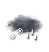
This morning
-1°
Feels Like -1°
Gusts
10 km/h
Calm
Very cloudy to overcast sky.
Snow showers followed by rain.
Risk of snow
90 %
UV index
2
Low
Freezing level 0°
1000 m
Snow-rain limit
700 m
Fresh snow
2 cm
This afternoon
4°
Feels Like 4°
Gusts
15 km/h
Calm
Very cloudy to overcast sky.
Risk of showers at the start of the afternoon.
Risk of rain
20 %
UV index
2
Low
Freezing level 0°
1400 m
Snow-rain limit
1100 m
Fresh snow
0 cm
This evening
1°
Feels Like 1°
Gusts
10 km/h
Calm
Overcast and misty. Limited visibility.
No precipitation.
No risk of rain
Freezing level 0°
1450 m
Snow-rain limit
1150 m
Fresh snow
0 cm
Night
1°
Feels Like 1°
Gusts
10 km/h
Calm
Mist and fog.
Risk of sleet showers.
Risk of rain
30 %
Freezing level 0°
1400 m
Snow-rain limit
1100 m
Fresh snow
0 cm
Tomorrow's weather
Weekend weather
Share
Link copied
Station Info
open
Sonnberglifte Wald am Schoberpass
Avalanche Risk
N.C.
Snow
N.C.
at the top (1200m)
N.C.
down (850m)
Snowfall
No snowfall in recent days
Track Info
Lifts
-/4
Snow Parks
N.C.
Nordic ski
N.C.
Back skiing
N.C.
Tracks
with
Ephemeris
Saturday 15 march
Day
+3 min
Waning
gibbous Moon
Sunrise
06h13
Sunset
18h06
Clement Hofbauer
Next few days
Tomorrow,
Sunday 16
-
|
-
-
-
km/h
Monday 17
-
|
-
-
-
km/h
Tuesday 18
-
|
-
-
-
km/h
Near
Sonnberglifte Wald am Schoberpass
Wald am Schoberpaß
Radmer an der Hasel
Radmer an der Stube
Sonnberg
Treglwang
Pisching
Kalwang
Schattenberg
Johnsbach
Weather France
Lyon
Marseille
Nice
Paris
Toulouse
Chamonix-Mont-Blanc
Charleville-Mézières
Chartres
Châteauroux
Chaumont
Cherbourg
Cholet