See all results
Your
favorites
édition
Become a V.I.P
Log in
Weather
United States
Radar
Mountain
World
Weather
France
Auvergne-Rhône-Alpes
Savoie
Queige
Col de la Forclaz
WEATHER COL DE LA FORCLAZ
Queige (73720) - Savoie - France
Sat
15
-
-
Sun
16
-
-
Mon
17
-
-
Tue
18
-
-
Wed
19
-
-
Thu
20
-
-
Fri
21
-
-
Sat
22
-
-
Sun
23
-
-
Mon
24
-
-
Tue
25
-
-
Wed
26
-
-
Thu
27
-
-
Fri
28
-
-
Sat
29
-
-
+
Day
Time / Hour
Compare
Today's Forecast
Forecast produced by
Cyrille DUCHESNE
Updated at
17h45
- Next update at
03h45
(local time)
In Short
Follow the weather
live
Hour by hour
Weather comparator
Infos Climat
Expert’s summary
Today in Col de la Forclaz, rain and snow will affect the region.
Temperatures will vary between 0 and 2°C.
The reliability of the situation is good.
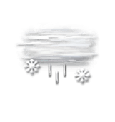
Tonight
0°
Feels Like -1°
Gusts
10 km/h
Calm
Overcast and misty. Limited visibility.
Drizzle mixed with sleet.
Risk of rain
95 %
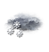
This morning
0°
Feels Like 0°
Gusts
10 km/h
Calm
Overcast and misty. Limited visibility.
Snow showers clearing later.
Risk of snow
70 %
UV index
1
Low
Fresh snow
2 cm
This afternoon
2°
Feels Like 3°
Gusts
15 km/h
Calm
Overcast and misty. Limited visibility.
Light sleet.
Risk of snow
90 %
UV index
1
Low
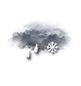
This evening
0°
Feels Like -1°
Gusts
10 km/h
Calm
Overcast and misty. Limited visibility.
Snow showers.
Risk of snow
90 %
Fresh snow
6 cm
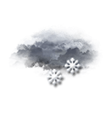
Night
-1°
Feels Like -1°
Gusts
10 km/h
Calm
Overcast and misty. Limited visibility.
Light snow showers.
Risk of snow
80 %
Fresh snow
3 cm
Tomorrow's weather
Weekend weather
Share
Link copied
CLIMATE info
Rain
+100%
normal
More rain than normal
Water restriction:
No restrictions
Temperature
-6°C
normal
Colder than normal
Normal temperature : 7°C
Average, today : 1°C
One year ago : 4°C
Drought
0
/5
No drought
Fire-risk indicator
Risk Low
Ephemeris
Saturday 15 march
Day
+3 min
Waning
gibbous Moon
Sunrise
06h46
Sunset
18h40
Clement Hofbauer
Next few days
Tomorrow,
Sunday 16
-
|
-
-
-
km/h
Monday 17
-
|
-
-
-
km/h
Tuesday 18
-
|
-
-
-
km/h
Near
Col de la Forclaz
Queige
Pallud
Césarches
Thénésol
Venthon
Allondaz
Albertville
Marthod
Conflans
Ugine
Mercury
Héry Sur Ugine (ski resort)
Weather France
Lyon
Marseille
Nice
Paris
Toulouse
Guéret
La Roche-sur-Yon
La Rochelle
Laon
Laval
Le Havre
Le Mans