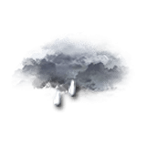
weather France Col de Châtillon
  • 15 day forecast

    - -
Time / Hour

Today's Forecast

Régis CRÊPET

Forecast produced by Régis CRÊPET

Updated at - Next update at (local time)

expert la chaîne météo Expert’s summary

Today in Col de Châtillon, after squalls early in the day, the instability will decrease considerably.
Temperatures will vary between 6 and 8°C.
The reliability of the situation is good.

Tonight


Intermittent light rain or light showers
Feels Like 7°
Gusts 45 km/h SW 10 km/h
Overcast and misty. Limited visibility.
Light rain followed by showers.
Risk of rain 100 %

This morning


Heavy intermittent rain, or heavy showers
Feels Like 5°
Gusts 30 km/h Calm
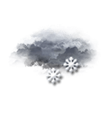
Overcast sky with a slight tendency to improvement.
Heavy showers clearing later.
Risk of rain 100 %
UV index 2 Low

This afternoon


Alternating sunshine and cloud
Feels Like 11° due to the sun
Gusts 20 km/h Calm
Sunny periods and passing clouds, sometimes heavy.
Slight risk of showers.
Risk of rain 20 %
UV index 4 Moderate

This evening


Alternating sunshine and cloud
Feels Like 4°
Gusts 20 km/h Calm
Clear periods and passing clouds, sometimes heavy.
No precipitation.
No risk of rain

Night


Slightly cloudy
Feels Like 2°
Gusts 10 km/h Calm
Good weather with few clouds.
No precipitation.
No risk of rain

CLIMATE info


Rain

+30%
normal
More rain than normal
Water restriction:
No restrictions

Temperature

-3°C
normal
Colder than normal
Normal temperature : 10°C
Average, today : 7°C
One year ago : 15°C

Drought

0/5
No drought
Fire-risk indicator
Risk Low

Ephemeris


Wednesday 2 october

  • Day
    -3 min
  • New
    Moon
  • Sunrise
    07h34
  • Sunset
    19h12
  • Leodegar

Next few days


Near Col de Châtillon