weather France Col du Goulet
  • 15 day forecast

Day

Hourly weather

Cyril BONNEFOY

Forecast produced by Cyril BONNEFOY

Updated at - Imminent update (local time)

Map settings
Models

We offer our satellite and rain radar maps of Col du Goulet and its surroundings.
Follow the movements, in real time, of clouds and rain in Occitania.
Enable lightning strikes to track the movement of storms.

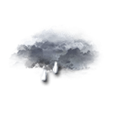
Rain from 12:35 am to tomorrow 7 am with a risk from 12:25 am.

Saturday 22


  • 5 min + 00h
  • 00h25
  • 00h30
  • 00h35
  • 00h40
  • 00h45
  • 00h50
  • 5 min + 00h55
  • 5 min + 01h
  • 5 min + 01h
  • 01h05
  • 01h10
  • 01h15
  • 01h20
  • 01h25
  • 01h30
  • 01h35
  • 01h40
  • 01h45
  • 01h50
  • 5 min + 01h55
  • 02h
  • 03h
  • 04h
  • 05h
  • 06h
  • 07h
  • 08h
  • 09h
  • 10h
  • 11h
  • 12h
  • 13h
  • 14h
  • 15h
  • 16h
  • 17h
  • 18h
  • 19h
  • 20h
  • 21h
  • 22h
  • 23h
  • 00h
Time Temperature Rain Wind
  • Low Moderate
  • Light rain Risk 85% Light rain SE 20 km/h Gusts 55
  • Overcast Risk 30% Slight chance of rain SE 20 km/h Gusts 55
  • Overcast Risk 35% Slight chance of rain SE 20 km/h Gusts 55
  • Rain Risk 50% Rain SE 20 km/h Gusts 55
  • Rain Risk 60% Rain SE 20 km/h Gusts 55
  • Rain Risk 70% Rain SE 20 km/h Gusts 55
  • Rain Risk 75% Rain SE 20 km/h Gusts 55
  • Rain Risk 85% Rain SE 20 km/h Gusts 55
  • Rain Risk 100% Rain SE 25 km/h Gusts 60
  • Rain Risk 90% Rain SE 20 km/h Gusts 55
  • Rain Risk 90% Rain SE 20 km/h Gusts 55
  • Rain Risk 95% Rain SE 20 km/h Gusts 55
  • Rain Risk 95% Rain SE 20 km/h Gusts 55
  • Rain Risk 95% Rain SE 25 km/h Gusts 55
  • Rain Risk 95% Rain SE 25 km/h Gusts 55
  • Rain Risk 95% Rain SE 25 km/h Gusts 55
  • Rain Risk 95% Rain SE 25 km/h Gusts 55
  • Rain Risk 100% Rain SE 25 km/h Gusts 60
  • Rain Risk 100% Rain SE 25 km/h Gusts 60
  • Rain Risk 100% Rain SE 25 km/h Gusts 60
  • Rain Risk 95% Rain SE 25 km/h Gusts 60
  • Light rain Risk 60% Light rain SE 25 km/h Gusts 65
  • Drizzle Risk 60% Drizzle SE 25 km/h Gusts 65
  • Drizzle Risk 60% Drizzle SE 30 km/h Gusts 65
  • Light rain Risk 70% Light rain SE 25 km/h Gusts 65
  • Drizzle Risk 75% Drizzle SE 25 km/h Gusts 60
  • Light rain Risk 85% Light rain SE 25 km/h Gusts 60
  • Light rain Risk 80% Light rain SE 20 km/h Gusts 55
  • Light rain Risk 80% Light rain SE 20 km/h Gusts 50
  • Light rain Risk 85% Light rain SE 20 km/h Gusts 45
  • Light rain Risk 95% Light rain SE 15 km/h Gusts 45
  • Light rain Risk 100% Light rain SE 15 km/h Gusts 40
  • Light rain Risk 95% Light rain SE 15 km/h Gusts 40
  • Light rain Risk 95% Light rain SE 15 km/h Gusts 40
  • Rain Risk 100% Rain SE 10 km/h Gusts 35
  • Rain Risk 100% Rain Calm Gusts 35
  • Rain Risk 95% Rain Calm Gusts 30
  • Rain Risk 95% Rain Calm Gusts 25
  • Rain Risk 95% Rain Calm Gusts 25
  • Rain Risk 100% Rain Calm Gusts 20
  • Light rain Risk 100% Light rain Calm Gusts 20
  • Light rain Risk 100% Light rain N 10 km/h Gusts 20
  • Light rain Risk 100% Light rain N 10 km/h Gusts 20
  • Rain Risk 90% Rain N 10 km/h Gusts 20
  • 50% 30% 10% 1900 20% 1000 lm uv 4 Moderate 44% Comfortable 1027 hPa excellent > 20 km excellent
  • 50% 30% 10% 1900 20% 1000 lm uv 4 Moderate 44% Comfortable 1027 hPa excellent > 20 km excellent
  • 50% 30% 10% 1900 20% 1000 lm uv 4 Moderate 44% Comfortable 1027 hPa excellent > 20 km excellent
  • 50% 30% 10% 1900 20% 1000 lm uv 4 Moderate 44% Comfortable 1027 hPa excellent > 20 km excellent
  • 50% 30% 10% 1900 20% 1000 lm uv 4 Moderate 44% Comfortable 1027 hPa excellent > 20 km excellent
  • 50% 30% 10% 1900 20% 1000 lm uv 4 Moderate 44% Comfortable 1027 hPa excellent > 20 km excellent
  • 50% 30% 10% 1900 20% 1000 lm uv 4 Moderate 44% Comfortable 1027 hPa excellent > 20 km excellent
  • 50% 30% 10% 1900 20% 1000 lm uv 4 Moderate 44% Comfortable 1027 hPa excellent > 20 km excellent
  • 50% 30% 10% 1900 20% 1000 lm uv 4 Moderate 44% Comfortable 1027 hPa excellent > 20 km excellent
  • 50% 30% 10% 1900 20% 1000 lm uv 4 Moderate 44% Comfortable 1027 hPa excellent > 20 km excellent
  • 50% 30% 10% 1900 20% 1000 lm uv 4 Moderate 44% Comfortable 1027 hPa excellent > 20 km excellent
  • 50% 30% 10% 1900 20% 1000 lm uv 4 Moderate 44% Comfortable 1027 hPa excellent > 20 km excellent
  • 50% 30% 10% 1900 20% 1000 lm uv 4 Moderate 44% Comfortable 1027 hPa excellent > 20 km excellent
  • 50% 30% 10% 1900 20% 1000 lm uv 4 Moderate 44% Comfortable 1027 hPa excellent > 20 km excellent
  • 50% 30% 10% 1900 20% 1000 lm uv 4 Moderate 44% Comfortable 1027 hPa excellent > 20 km excellent
  • 50% 30% 10% 1900 20% 1000 lm uv 4 Moderate 44% Comfortable 1027 hPa excellent > 20 km excellent
  • 50% 30% 10% 1900 20% 1000 lm uv 4 Moderate 44% Comfortable 1027 hPa excellent > 20 km excellent
  • 50% 30% 10% 1900 20% 1000 lm uv 4 Moderate 44% Comfortable 1027 hPa excellent > 20 km excellent
  • 50% 30% 10% 1900 20% 1000 lm uv 4 Moderate 44% Comfortable 1027 hPa excellent > 20 km excellent
  • 50% 30% 10% 1900 20% 1000 lm uv 4 Moderate 44% Comfortable 1027 hPa excellent > 20 km excellent
  • 50% 30% 10% 1900 20% 1000 lm uv 4 Moderate 44% Comfortable 1027 hPa excellent > 20 km excellent
  • 50% 30% 10% 1900 20% 1000 lm uv 4 Moderate 44% Comfortable 1027 hPa excellent > 20 km excellent
  • 50% 30% 10% 1900 20% 1000 lm uv 4 Moderate 44% Comfortable 1027 hPa excellent > 20 km excellent
  • 50% 30% 10% 1900 20% 1000 lm uv 4 Moderate 44% Comfortable 1027 hPa excellent > 20 km excellent
  • 50% 30% 10% 1900 20% 1000 lm uv 4 Moderate 44% Comfortable 1027 hPa excellent > 20 km excellent
  • 50% 30% 10% 1900 20% 1000 lm uv 4 Moderate 44% Comfortable 1027 hPa excellent > 20 km excellent
  • 50% 30% 10% 1900 20% 1000 lm uv 4 Moderate 44% Comfortable 1027 hPa excellent > 20 km excellent
  • 50% 30% 10% 1900 20% 1000 lm uv 4 Moderate 44% Comfortable 1027 hPa excellent > 20 km excellent
  • 50% 30% 10% 1900 20% 1000 lm uv 4 Moderate 44% Comfortable 1027 hPa excellent > 20 km excellent
  • 50% 30% 10% 1900 20% 1000 lm uv 4 Moderate 44% Comfortable 1027 hPa excellent > 20 km excellent
  • 50% 30% 10% 1900 20% 1000 lm uv 4 Moderate 44% Comfortable 1027 hPa excellent > 20 km excellent
  • 50% 30% 10% 1900 20% 1000 lm uv 4 Moderate 44% Comfortable 1027 hPa excellent > 20 km excellent
  • 50% 30% 10% 1900 20% 1000 lm uv 4 Moderate 44% Comfortable 1027 hPa excellent > 20 km excellent
  • 50% 30% 10% 1900 20% 1000 lm uv 4 Moderate 44% Comfortable 1027 hPa excellent > 20 km excellent
  • 50% 30% 10% 1900 20% 1000 lm uv 4 Moderate 44% Comfortable 1027 hPa excellent > 20 km excellent
  • 50% 30% 10% 1900 20% 1000 lm uv 4 Moderate 44% Comfortable 1027 hPa excellent > 20 km excellent
  • 50% 30% 10% 1900 20% 1000 lm uv 4 Moderate 44% Comfortable 1027 hPa excellent > 20 km excellent
  • 50% 30% 10% 1900 20% 1000 lm uv 4 Moderate 44% Comfortable 1027 hPa excellent > 20 km excellent
  • 50% 30% 10% 1900 20% 1000 lm uv 4 Moderate 44% Comfortable 1027 hPa excellent > 20 km excellent
  • 50% 30% 10% 1900 20% 1000 lm uv 4 Moderate 44% Comfortable 1027 hPa excellent > 20 km excellent
  • 50% 30% 10% 1900 20% 1000 lm uv 4 Moderate 44% Comfortable 1027 hPa excellent > 20 km excellent
  • 50% 30% 10% 1900 20% 1000 lm uv 4 Moderate 44% Comfortable 1027 hPa excellent > 20 km excellent
  • 50% 30% 10% 1900 20% 1000 lm uv 4 Moderate 44% Comfortable 1027 hPa excellent > 20 km excellent
  • 50% 30% 10% 1900 20% 1000 lm uv 4 Moderate 44% Comfortable 1027 hPa excellent > 20 km excellent
These parameters are reserved for subscribers.
You have 50% to discover:

Precipitation amount, cloud cover, light index, UV index, air humidity, air pressure and visibility.
logo VIP
  • Faster browsing
  • Detailed weather forecast
  • No ads
  • Access to Live TV

CLIMATE info


Rain

-70%
normal
Less rain than normal
Water restriction:
No restrictions

Temperature

+3°C
normal
Warmer than normal
Normal temperature : 1°C
Average, today : 4°C
One year ago : 4°C

Drought

0/5
No drought
Fire-risk indicator
Risk Low

Ephemeris


Saturday 22 february

  • Day
    +3 min
  • Waning
    crescent Moon
  • Sunrise
    07h33
  • Sunset
    18h23
  • Margaret of Cortona

Next few days


Points of interest arround Le Bleymard


Near Col du Goulet