See all results
Your
favorites
édition
Become a V.I.P
Log in
Weather
United States
Radar
Mountain
World
Weather
France
Auvergne-Rhône-Alpes
Savoie
Lanslevillard
Col de la Met
WEATHER COL DE LA MET
Lanslevillard (73480) - Savoie - France
Thu
21
-
-
Fri
22
-
-
Sat
23
-
-
Sun
24
-
-
Mon
25
-
-
Tue
26
-
-
Wed
27
-
-
Thu
28
-
-
Fri
29
-
-
Sat
30
-
-
Sun
01
-
-
Mon
02
-
-
Tue
03
-
-
Wed
04
-
-
Thu
05
-
-
+
Day
Time / Hour
Compare
Today's Forecast
In Short
Follow the weather
live
Hour by hour
Weather comparator
Videos
Infos Climat
Expert’s summary
Tonight in Col de la Met, strong wind warning.
Temperatures will vary between -6 and -2°C.
The reliability of the situation is relatively good.
This evening
-4°
Feels Like -12°
due to the wind
Gusts
130 km/h
W 50 km/h
Very cloudy to overcast sky.
Snow showers.
Risk of snow
100 %
Fresh snow
21 cm
Night
-11°
Feels Like -16°
due to the wind
Gusts
95 km/h
NW 35 km/h
Overcast sky.
Light snow showers.
Risk of snow
60 %
Fresh snow
2 cm
Tomorrow's weather
Weekend weather
Receive the weather forecast for my town or city
Share
Link copied
CLIMATE info
Rain
+60%
normal
More rain than normal
Water restriction:
No restrictions
Temperature
-2°C
normal
Colder than normal
Normal temperature : -3°C
Average, today : -5°C
One year ago : -4°C
Drought
0
/5
No drought
Fire-risk indicator
Risk Low
Ephemeris
Thursday 21 november
Day
-2 min
Waning
gibbous
Sunrise
07h39
Sunset
16h57
Gelasius
Next few days
Tomorrow,
Friday 22
-
|
-
-
-
km/h
This weekend,
Saturday 23
-
|
-
-
-
km/h
Sunday 24
-
|
-
-
-
km/h
Points of interest
arround Lanslevillard
Natural-sites
Col de la Madeleine
Col de la Tomba
Col du Lou
Col du Mont Cenis
Near
Col de la Met
Lanslevillard
Val Cenis (ski resort)
Lanslebourg-Mont-Cenis
Bessans (ski resort)
Termignon (ski resort)
Termignon
Sollières Sardières (ski resort)
Bessans
Sollières-Sardières
Weather France
Lyon
Marseille
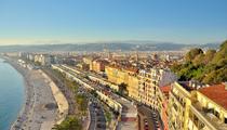
Nice
Paris
Toulouse
Dijon
Épinal
Évreux
Évry
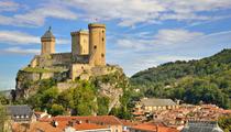
Foix
Gap
Grenoble