Today in Col Lady Lister, rain and snow will affect the region in the second half of the day.
Temperatures will vary between -9 and -2°C, it will be very cold in the morning and 4°C below normal.
The reliability of the situation is limited.
Tonight
-10°Feels Like -11°
Gusts 15 km/hCalm
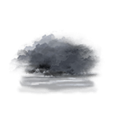
Overcast sky becoming unsettled.
Warning: conditions favourable to black ice.
No risk of rain
Freezing level 0°
2000 m
Snow-rain limit
1700 m
Snow expected
0 cm
This morning
-9°Feels Like -10°
Gusts 20 km/hCalm
Very cloudy sky turning overcast.
No precipitation.
No risk of rain
UV index2Low
Freezing level 0°
2050 m
Snow-rain limit
1750 m
Snow expected
0 cm
This afternoon
-2°Feels Like -2°
Gusts 30 km/hW 10 km/h
Overcast sky.
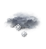
Snow showers starting to fall at the end of the afternoon.
Risk of snow
75 %
UV index2Low
Snow expected0.3 cm
Freezing level 0°
2150 m
Snow-rain limit
1850 m
Snow expected
< 1cm
This evening
-4°Feels Like -6°
Gusts 45 km/hN 10 km/h
Overcast and misty. Limited visibility.
Slight risk of showers.
Risk of snow
25 %
Freezing level 0°
1950 m
Snow-rain limit
1650 m
Snow expected
0 cm
Night
-8°Feels Like -9°
Gusts 35 km/hNE 10 km/h
Clear periods and passing clouds, sometimes heavy.
Warning: conditions favourable to black ice.
No risk of rain
Freezing level 0°
1900 m
Snow-rain limit
1600 m
Snow expected
0 cm
Share
CLIMATE info
Rain
+100%
normal
More rain than normal
Water restriction: No restrictions
Temperature
-5°C
normal
Colder than normal
Normal temperature : -1°C
Average, today :
-6°C
One year ago : 0°C