Today in Col de Pionnier, warning: increasingly sustained gusts.
Temperatures will vary between 4 and 8°C, it will be cold in the morning and with values close to normal.
The reliability of the situation is relatively good.
9:00 to 12:00
6°Feels Like 4°
Gusts 45 km/hS 15 km/h
Very cloudy sky with short sunny periods.
No precipitation.
No risk of rain
UV index1Low
Freezing level 0°
1900 m
Snow-rain limit
1600 m
Snow expected
0 cm
This afternoon
8°Feels Like 7°
Gusts 50 km/hS 20 km/h
Very cloudy sky turning overcast.
A few light showers.
Risk of rain
65 %
UV index2Low
Freezing level 0°
1950 m
Snow-rain limit
1650 m
Snow expected
0 cm
This evening
6°Feels Like 5°
Gusts 40 km/hS 15 km/h
Very cloudy to overcast sky.
Rain followed by showers.
Risk of rain
90 %
Freezing level 0°
1800 m
Snow-rain limit
1500 m
Snow expected
0 cm
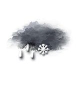
Night
4°Feels Like 0°due to the wind
Gusts 50 km/hN 20 km/h
Overcast and misty. Limited visibility.
Sleet showers.
Risk of rain
70 %
Freezing level 0°
1400 m
Snow-rain limit
1100 m
Snow expected
0 cm
Share
CLIMATE info
Rain
+75%
normal
More rain than normal
Water restriction: No restrictions
Temperature
+1°C
normal
Warmer than normal
Normal temperature : 5°C
Average, today :
6°C
One year ago : 7°C