See all results
Your
favorites
édition
Become a V.I.P
Log in
Weather
United States
Radar
Mountain
World
Weather
United Kingdom
Nevis Range (ski resort)
WEATHER SKI RESORT NEVIS RANGE
Fort William - United Kingdom
Mon
03
-
-
Tue
04
-
-
Wed
05
-
-
Thu
06
-
-
Fri
07
-
-
Sat
08
-
-
Sun
09
-
-
Mon
10
-
-
Tue
11
-
-
Wed
12
-
-
Thu
13
-
-
Fri
14
-
-
Sat
15
-
-
Sun
16
-
-
Mon
17
-
-
+
Day
Time / Hour
Compare
Today's Forecast
Forecast produced by
Régis CRÊPET
Updated at
21h15
- Next update at
03h15
(local time)
In Short
N.C.
Ski resort info
Follow the weather
live
Hour by hour
Weather comparator
Expert’s summary
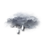
Today in Nevis Range, danger: deteriorating rapidly with very violent gusts in the afternoon.
Temperatures will vary between 7 and 9°C.
The reliability of the situation is good.
Tonight
6°
Feels Like 4°
due to the wind
Gusts
70 km/h
S 15 km/h
Very cloudy sky turning overcast.
Showers followed by rain.
Risk of rain
100 %
Freezing level 0°
1200 m
Snow-rain limit
900 m
Fresh snow
0 cm
This morning
7°
Feels Like 5°
due to the wind
Gusts
30 km/h
W 15 km/h
Very cloudy to overcast sky.
Light rain.
Risk of rain
90 %
UV index
0
Low
Freezing level 0°
1800 m
Snow-rain limit
1500 m
Fresh snow
0 cm
This afternoon
9°
Feels Like 6°
due to the wind
Gusts
95 km/h
SW 25 km/h
Very cloudy sky with short sunny periods.
Light showers followed by rain.
Risk of rain
90 %
UV index
0
Low
Freezing level 0°
1750 m
Snow-rain limit
1450 m
Fresh snow
0 cm
This evening
9°
Feels Like 6°
due to the wind
Gusts
50 km/h
SW 20 km/h
Overcast sky.
Rain.
Risk of rain
90 %
Freezing level 0°
1750 m
Snow-rain limit
1400 m
Fresh snow
0 cm
Night
8°
Feels Like 6°
Gusts
30 km/h
SW 10 km/h
Overcast sky.
Rain.
Risk of rain
90 %
Freezing level 0°
1650 m
Snow-rain limit
1300 m
Fresh snow
0 cm
Tomorrow's weather
Weekend weather
Receive the weather forecast for my ski resort
Share
Link copied
Station Info
Closed
Nevis Range
opening scheduled on 13/02/2025 at 09/03/2025
Snow
5 cm
at the top (650m)
N.C.
down (100m)
Snowfall
1 month ago : 1 cm
1 month ago : 8 cm
Track Info
Lifts
-/12
Snow Parks
-/1
Nordic ski
N.C.
Back skiing
N.C.
Tracks
N.C
N.C
N.C
N.C
with
Ephemeris
Monday 3 february
Day
+4 min
Waxing
crescent
Sunrise
08h13
Sunset
16h54
Anskar
Next few days
Tomorrow,
Tuesday 04
-
|
-
-
-
km/h
Wednesday 05
-
|
-
-
-
km/h
Thursday 06
-
|
-
-
-
km/h
Near
Nevis Range
Fort William
Glen Nevis
Claggan
Inverlochy
Upper Achintore
Caol
Banavie
Achaphubuil
Corpach
Weather United Kingdom
Glasgow
Liverpool
Leeds
Birmingham
Londres
Portree
Coleraine
Ashford
Broadstairs
Cambridge
City of Westminster
Clitheroe